SLspatial provides spatial boundary datasets for Sri Lanka as simple features (sf) objects. The package supports mapping, spatial analysis, and integration of administrative and electoral geographic data. It includes the country boundary, administrative districts, electoral districts, electoral polling divisions, and administrative divisions. The datasets support analysis at multiple geographic levels while distinguishing administrative from electoral geography.
Installation
Install the development version from GitHub:
# install.packages("remotes")
remotes::install_github("Amalan-ConStat/SLspatial")
Available datasets
| Dataset | Features | Coverage | Key attributes |
|---|---|---|---|
SLBoundary |
1 | Sri Lanka country boundary |
Country, ISO2, ISO3
|
SLAdministrativeDistricts |
25 | Administrative districts |
SourceID, SourceName, District
|
SLElectoralDistricts |
22 | Electoral districts | District |
SLElectorate |
160 | Electoral polling divisions across 22 electoral districts |
ElecCode, District, Electorate, OrigName
|
SLAdminDivisions |
323 | Administrative divisions across 25 administrative districts |
DistCode, District, EDistrict, DivCode, Division
|
All five datasets are sf objects with a geometry column. Counts reflect the source boundary versions used in the package and should not be interpreted as a statement about current official administrative boundaries.
SLBoundary
A single-feature country boundary, with country name and ISO two- and three-letter codes. The geometry is a MULTIPOLYGON in WGS84 (EPSG:4326).
SLAdministrativeDistricts
The 25 administrative district polygons. SourceID and SourceName preserve identifiers and names from the source; District uses election-aligned labels for selected districts (such as Digamadulla for Ampara). The geometry remains administrative: Kilinochchi and Jaffna, and the three administrative districts associated with Vanni, remain separate features.
SLElectoralDistricts
The 22 electoral district polygons, derived from SLAdministrativeDistricts. Jaffna and Kilinochchi are combined into the Jaffna electoral district; Mannar, Mullaitivu, and Vavuniya are combined into Vanni. The remaining districts retain their administrative boundaries. This is a derived layer, not an independently sourced official electoral-boundary file.
SLElectorate
The 160 electorate (polling division) polygons, with ElecCode, District, Electorate, and OrigName. Names were harmonised with the 2024 presidential election data where possible. Three names were manually assigned rather than confirmed through an exact election-data match.
SLAdminDivisions
The 323 administrative division polygons, with DistCode, District, EDistrict, DivCode, and Division. District refers to the administrative district; EDistrict is the corresponding electoral district label, allowing aggregation or grouping by either geography.
Administrative districts and electoral districts are not interchangeable. Use SLElectoralDistricts for electoral district geometry and SLAdministrativeDistricts for administrative district geometry. In particular, avoid interpreting the election-aligned District labels in SLAdministrativeDistricts as meaning that the polygons themselves have been merged.
Getting started
library(SLspatial)
library(sf)
library(dplyr)
library(ggplot2)

# Inspect the datasets
lapply(
  list(SLBoundary = SLBoundary,
       SLAdministrativeDistricts = SLAdministrativeDistricts,
       SLElectoralDistricts = SLElectoralDistricts,
       SLElectorate = SLElectorate,
       SLAdminDivisions = SLAdminDivisions),
  nrow
)
#> $SLBoundary
#> [1] 1
#>
#> $SLAdministrativeDistricts
#> [1] 25
#>
#> $SLElectoralDistricts
#> [1] 22
#>
#> $SLElectorate
#> [1] 160
#>
#> $SLAdminDivisions
#> [1] 323

head(st_drop_geometry(SLElectorate))
#>   ElecCode    District   Electorate    OrigName
#> 1   EC-21A   Ratnapura  Eheliyagoda Eheliyagoda
#> 2   EC-13C Digamadulla     Kalmunai    Kalmunai
#> 3   EC-20C  Monaragala    Wellawaya   Wellawaya
#> 4   EC-12C  Batticaloa   Paddiruppu  Paddiruppu
#> 5   EC-13B Digamadulla Sammanthurai Samanthurai
#> 6   EC-18A Polonnaruwa    Minneriya   Minneriya
head(st_drop_geometry(SLAdminDivisions))
#>   DistCode District   EDistrict DivCode        Division
#> 1        1   Ampara Digamadulla       1  Addalachchenai
#> 2        1   Ampara Digamadulla       2    Akkaraipattu
#> 3        1   Ampara Digamadulla       3    Alayadiwembu
#> 4        1   Ampara Digamadulla       4          Ampara
#> 5        1   Ampara Digamadulla       5          Damana
#> 6        1   Ampara Digamadulla       6 Dehiattakandiya
Mapping the country and district boundaries
Plot the national boundary:
ggplot(SLBoundary) +
  geom_sf(fill = "lightblue", colour = "grey30", linewidth = 0.3) +
  coord_sf(datum = NA) +
  theme_minimal() +
  labs(title = "Sri Lanka: Country Boundary")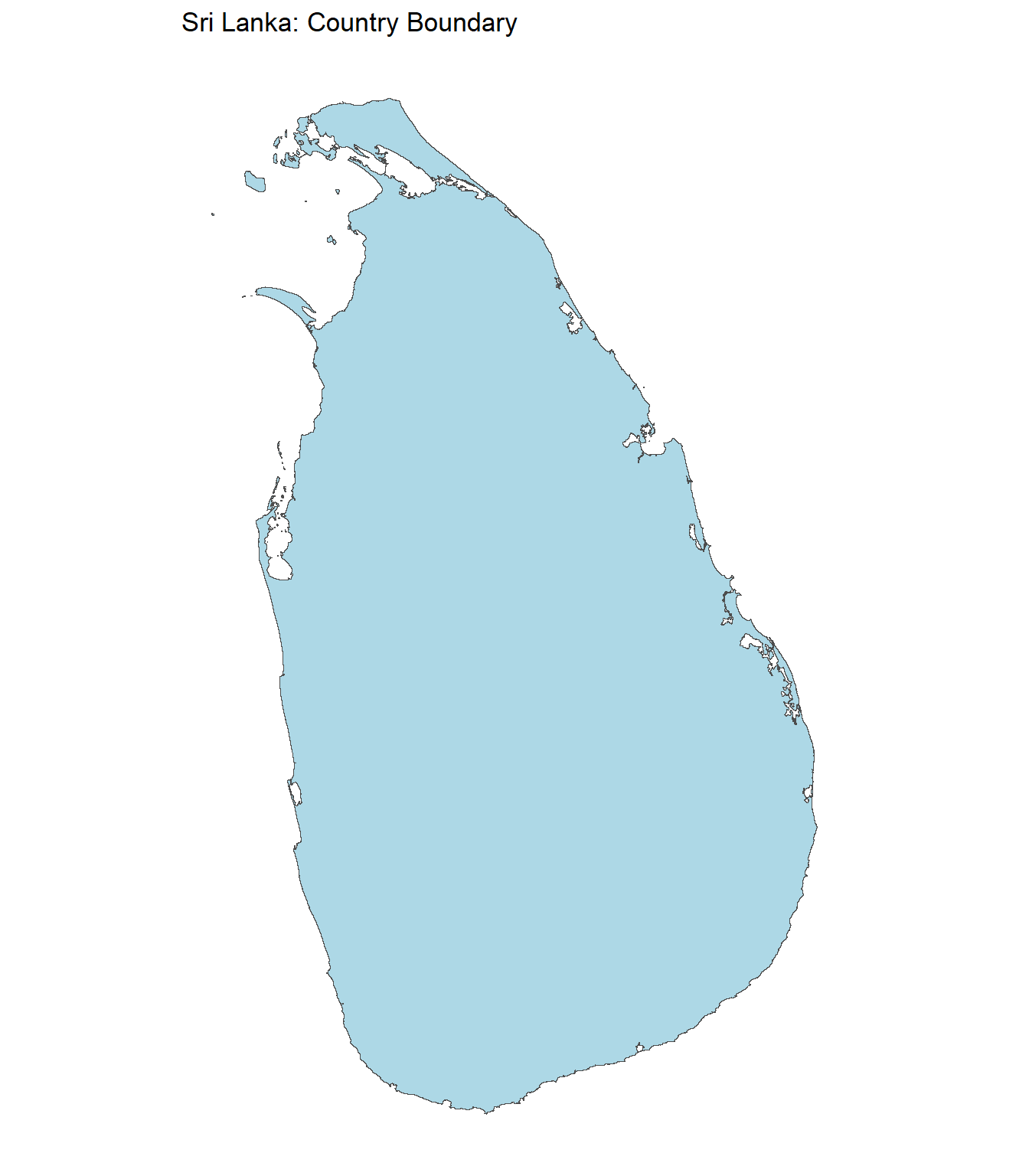
Plot the 25 administrative districts:
ggplot(SLAdministrativeDistricts) +
  geom_sf(fill = "lightblue", colour = "grey30", linewidth = 0.3) +
  coord_sf(datum = NA) +
  theme_minimal() +
  labs(title = "Sri Lanka: 25 Administrative Districts")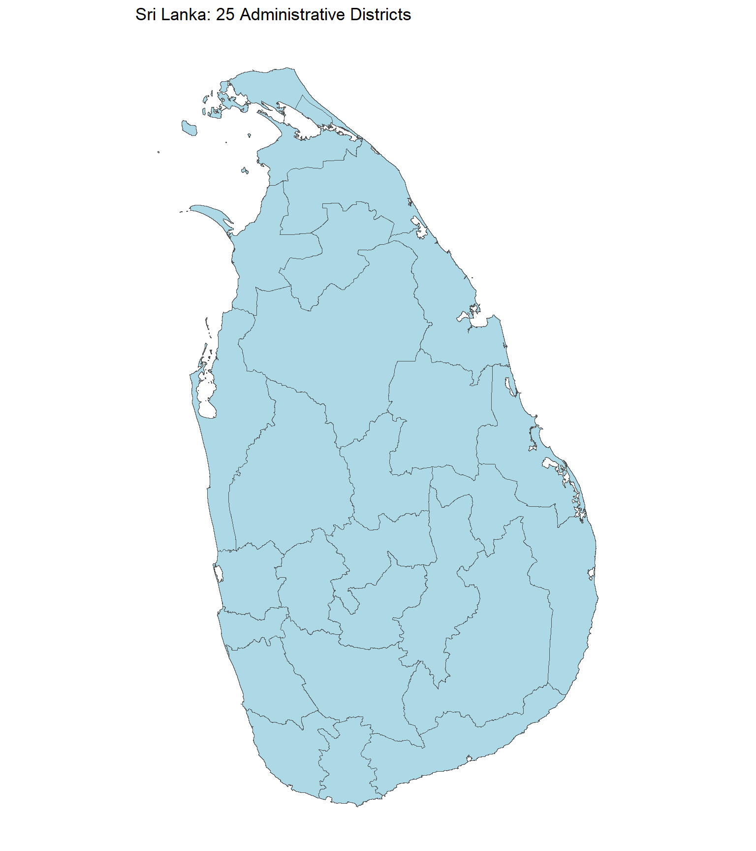
Plot the 22 derived electoral districts:
ggplot(SLElectoralDistricts) +
  geom_sf(fill = "lightblue", colour = "grey30", linewidth = 0.3) +
  coord_sf(datum = NA) +
  theme_minimal() +
  labs(title = "Sri Lanka: 22 Electoral Districts")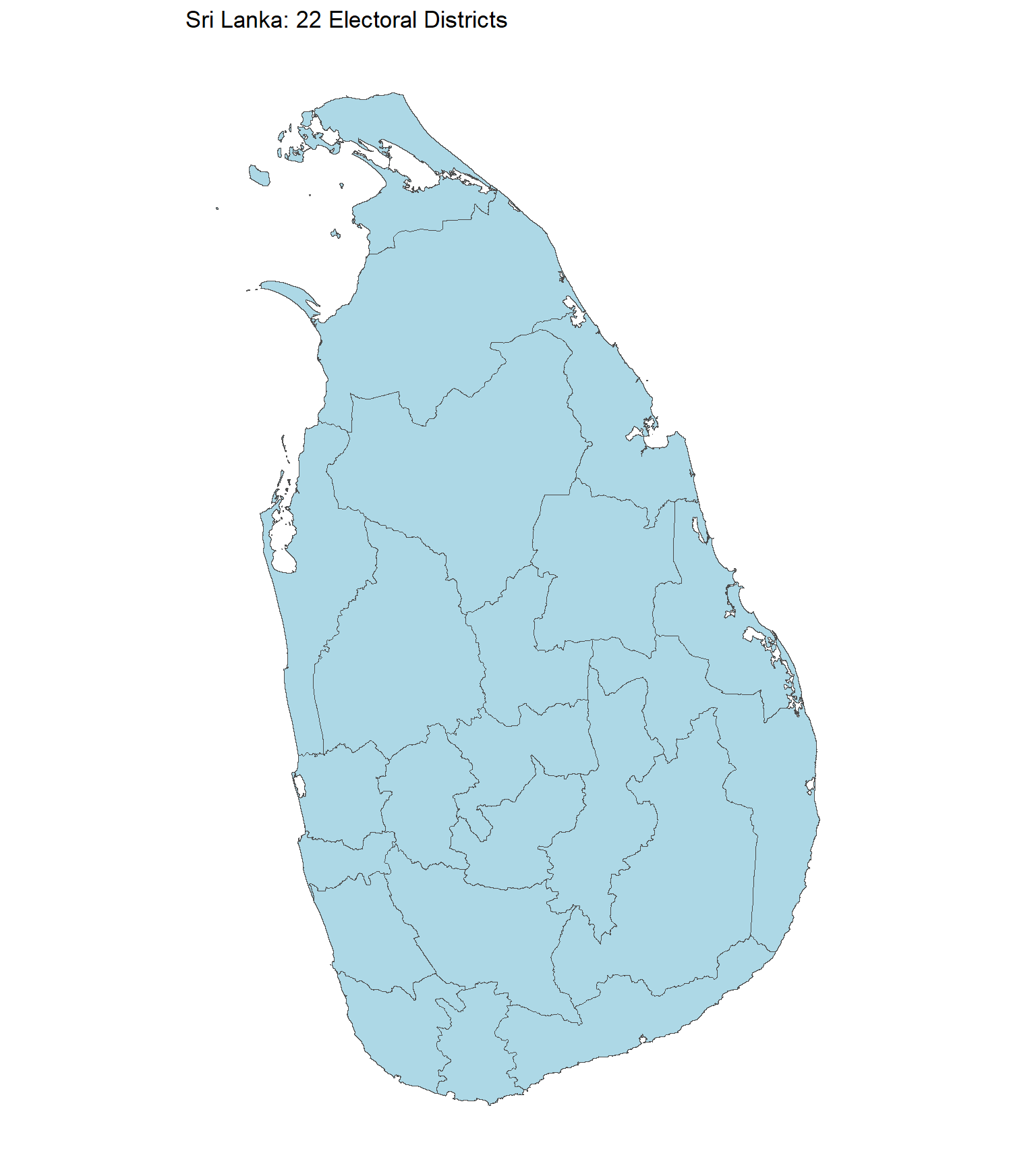
Mapping electoral polling divisions
ggplot(SLElectorate) +
  geom_sf(fill = "lightblue", colour = "grey35", linewidth = 0.15) +
  coord_sf(datum = NA) +
  theme_minimal() +
  labs(title = "Sri Lanka: Electoral Polling Divisions")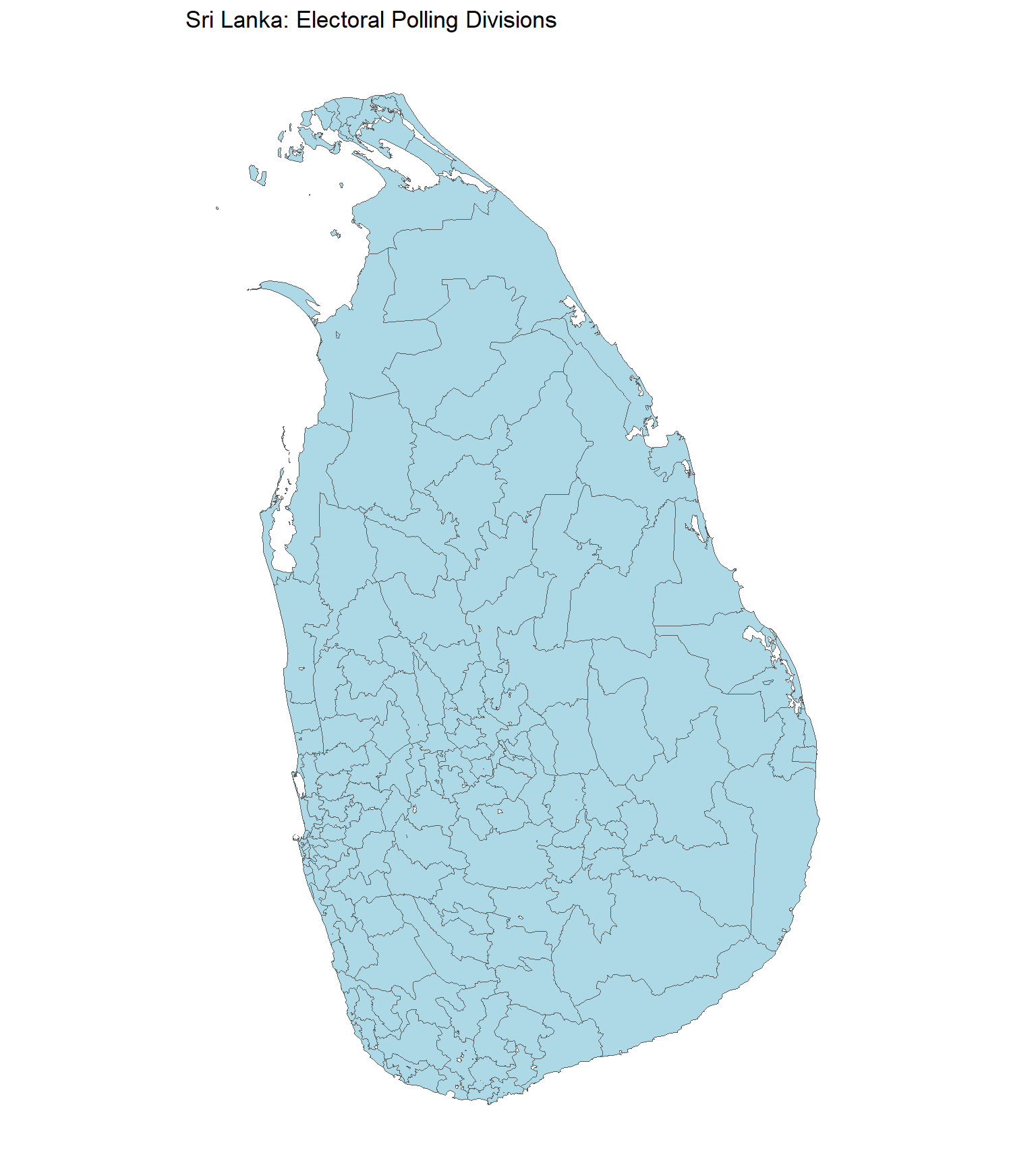
ggplot(SLElectorate) +
  geom_sf(aes(fill = District), colour = "white", linewidth = 0.12) +
  coord_sf(datum = NA) +
  theme_minimal() +
  theme(legend.position = "right") +
  labs(title = "Sri Lanka: Polling Divisions by Electoral District",
       fill = "Electoral district")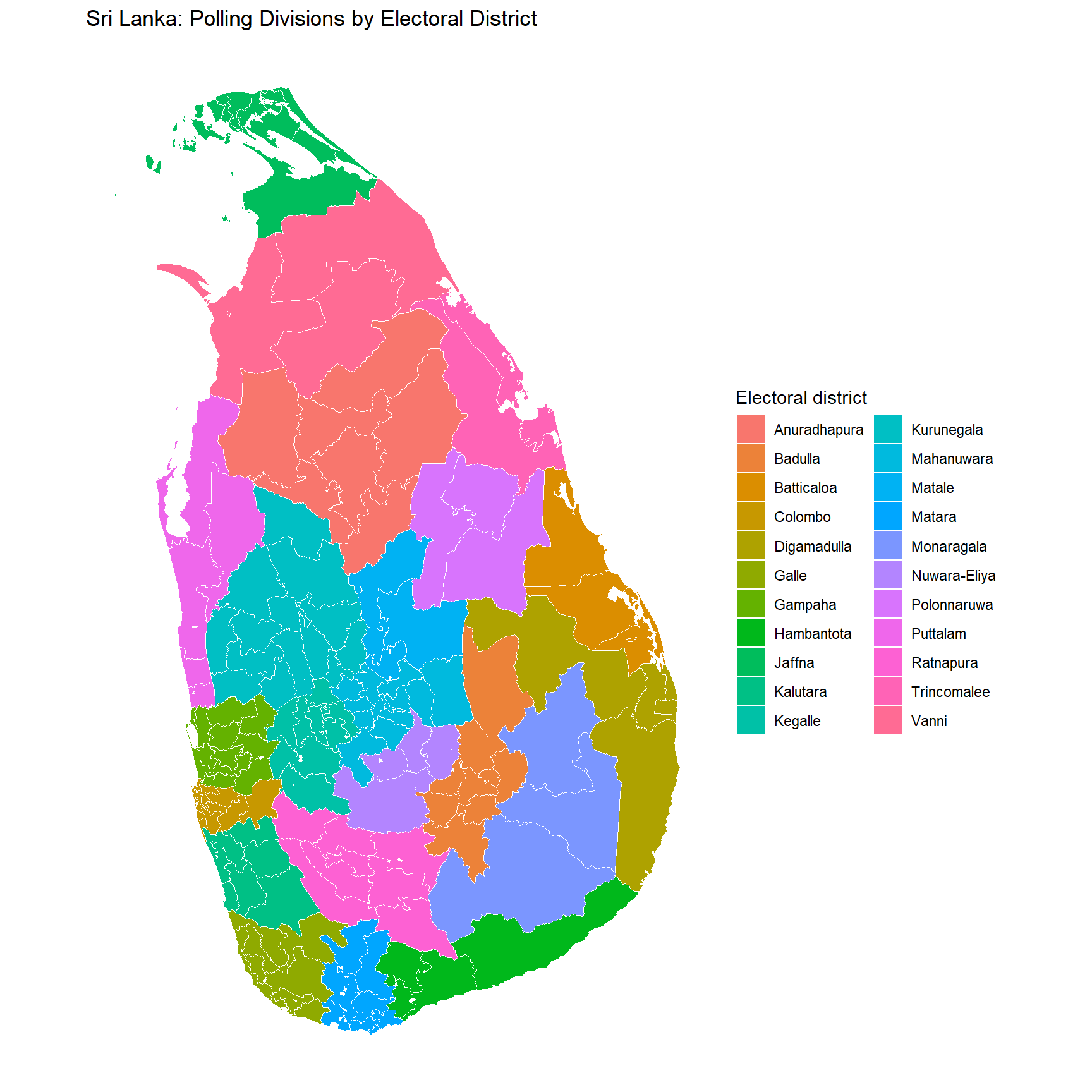
Mapping administrative divisions
ggplot(SLAdminDivisions) +
  geom_sf(fill = "lightblue", colour = "grey35", linewidth = 0.12) +
  coord_sf(datum = NA) +
  theme_minimal() +
  labs(title = "Sri Lanka: Administrative Divisions")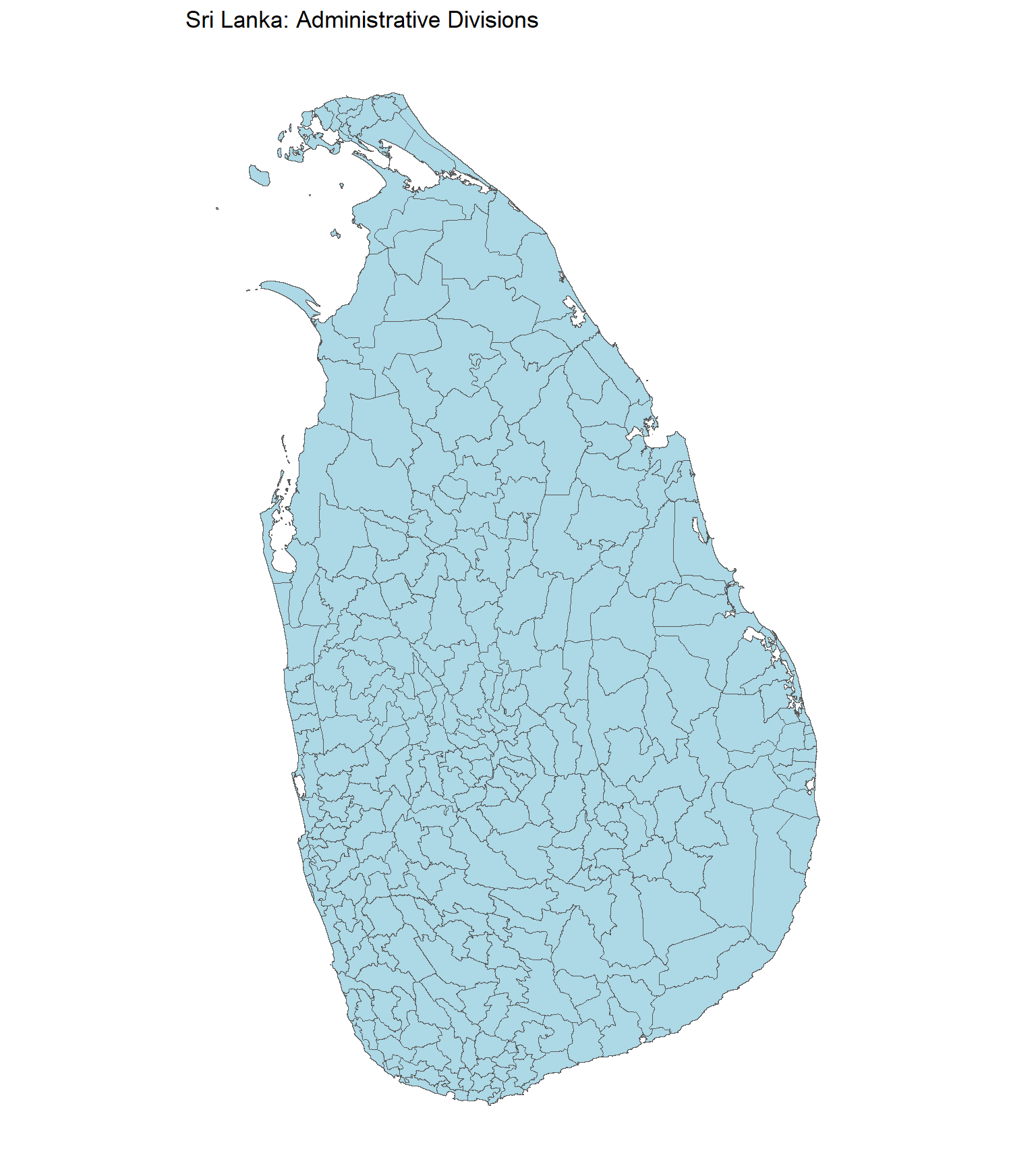
Exploring administrative and electoral districts
Count administrative divisions within each administrative district:
SLAdminDivisions |>
  st_drop_geometry() |>
  count(District, name = "AdministrativeDivisions") |>
  arrange(District)
#>        District AdministrativeDivisions
#> 1        Ampara                      19
#> 2  Anuradhapura                      22
#> 3       Badulla                      15
#> 4    Batticaloa                      12
#> 5       Colombo                      12
#> 6         Galle                      18
#> 7       Gampaha                      13
#> 8    Hambantota                      11
#> 9        Jaffna                      14
#> 10     Kalutara                      14
#> 11        Kandy                      20
#> 12      Kegalle                      11
#> 13  Kilinochchi                       4
#> 14   Kurunegala                      30
#> 15       Mannar                       5
#> 16       Matale                      11
#> 17       Matara                      16
#> 18   Moneragala                      11
#> 19   Mullaitivu                       5
#> 20 Nuwara Eliya                       5
#> 21  Polonnaruwa                       7
#> 22     Puttalam                      16
#> 23    Ratnapura                      17
#> 24  Trincomalee                      11
#> 25     Vavuniya                       4
Examine the correspondence between administrative and electoral districts:
SLAdminDivisions |>
  st_drop_geometry() |>
  distinct(District, EDistrict) |>
  arrange(EDistrict, District)
#>        District    EDistrict
#> 1  Anuradhapura Anuradhapura
#> 2       Badulla      Badulla
#> 3    Batticaloa   Batticaloa
#> 4       Colombo      Colombo
#> 5        Ampara  Digamadulla
#> 6         Galle        Galle
#> 7       Gampaha      Gampaha
#> 8    Hambantota   Hambantota
#> 9        Jaffna       Jaffna
#> 10  Kilinochchi       Jaffna
#> 11     Kalutara     Kalutara
#> 12      Kegalle      Kegalle
#> 13   Kurunegala   Kurunegala
#> 14        Kandy   Mahanuwara
#> 15       Matale       Matale
#> 16       Matara       Matara
#> 17   Moneragala   Monaragala
#> 18 Nuwara Eliya Nuwara-Eliya
#> 19  Polonnaruwa  Polonnaruwa
#> 20     Puttalam     Puttalam
#> 21    Ratnapura    Ratnapura
#> 22  Trincomalee  Trincomalee
#> 23       Mannar        Vanni
#> 24   Mullaitivu        Vanni
#> 25     Vavuniya        Vanni
Count administrative divisions within each electoral district:
SLAdminDivisions |>
  st_drop_geometry() |>
  count(EDistrict, name = "AdministrativeDivisions") |>
  arrange(EDistrict)
#>       EDistrict AdministrativeDivisions
#> 1  Anuradhapura                      22
#> 2       Badulla                      15
#> 3    Batticaloa                      12
#> 4       Colombo                      12
#> 5   Digamadulla                      19
#> 6         Galle                      18
#> 7       Gampaha                      13
#> 8    Hambantota                      11
#> 9        Jaffna                      18
#> 10     Kalutara                      14
#> 11      Kegalle                      11
#> 12   Kurunegala                      30
#> 13   Mahanuwara                      20
#> 14       Matale                      11
#> 15       Matara                      16
#> 16   Monaragala                      11
#> 17 Nuwara-Eliya                       5
#> 18  Polonnaruwa                       7
#> 19     Puttalam                      16
#> 20    Ratnapura                      17
#> 21  Trincomalee                      11
#> 22        Vanni                      14
Coordinate reference systems and spatial operations
The datasets retain their source geometries and coordinate reference systems. Check the CRS before combining layers or calculating distances and areas. Transform both layers to an appropriate common CRS when performing spatial operations.
st_crs(SLBoundary)
#> Coordinate Reference System:
#>   User input: WGS 84
#>   wkt:
#> GEOGCRS["WGS 84",
#>     DATUM["World Geodetic System 1984",
#>         ELLIPSOID["WGS 84",6378137,298.257223563,
#>             LENGTHUNIT["metre",1]]],
#>     PRIMEM["Greenwich",0,
#>         ANGLEUNIT["degree",0.0174532925199433]],
#>     CS[ellipsoidal,2],
#>         AXIS["latitude",north,
#>             ORDER[1],
#>             ANGLEUNIT["degree",0.0174532925199433]],
#>         AXIS["longitude",east,
#>             ORDER[2],
#>             ANGLEUNIT["degree",0.0174532925199433]],
#>     ID["EPSG",4326]]
st_crs(SLAdministrativeDistricts)
#> Coordinate Reference System:
#>   User input: WGS 84
#>   wkt:
#> GEOGCRS["WGS 84",
#>     DATUM["World Geodetic System 1984",
#>         ELLIPSOID["WGS 84",6378137,298.257223563,
#>             LENGTHUNIT["metre",1]]],
#>     PRIMEM["Greenwich",0,
#>         ANGLEUNIT["degree",0.0174532925199433]],
#>     CS[ellipsoidal,2],
#>         AXIS["latitude",north,
#>             ORDER[1],
#>             ANGLEUNIT["degree",0.0174532925199433]],
#>         AXIS["longitude",east,
#>             ORDER[2],
#>             ANGLEUNIT["degree",0.0174532925199433]],
#>     ID["EPSG",4326]]
st_crs(SLElectoralDistricts)
#> Coordinate Reference System:
#>   User input: WGS 84
#>   wkt:
#> GEOGCRS["WGS 84",
#>     DATUM["World Geodetic System 1984",
#>         ELLIPSOID["WGS 84",6378137,298.257223563,
#>             LENGTHUNIT["metre",1]]],
#>     PRIMEM["Greenwich",0,
#>         ANGLEUNIT["degree",0.0174532925199433]],
#>     CS[ellipsoidal,2],
#>         AXIS["latitude",north,
#>             ORDER[1],
#>             ANGLEUNIT["degree",0.0174532925199433]],
#>         AXIS["longitude",east,
#>             ORDER[2],
#>             ANGLEUNIT["degree",0.0174532925199433]],
#>     ID["EPSG",4326]]
st_crs(SLElectorate)
#> Coordinate Reference System:
#>   User input: EPSG:4326
#>   wkt:
#> GEOGCRS["WGS 84",
#>     ENSEMBLE["World Geodetic System 1984 ensemble",
#>         MEMBER["World Geodetic System 1984 (Transit)"],
#>         MEMBER["World Geodetic System 1984 (G730)"],
#>         MEMBER["World Geodetic System 1984 (G873)"],
#>         MEMBER["World Geodetic System 1984 (G1150)"],
#>         MEMBER["World Geodetic System 1984 (G1674)"],
#>         MEMBER["World Geodetic System 1984 (G1762)"],
#>         MEMBER["World Geodetic System 1984 (G2139)"],
#>         MEMBER["World Geodetic System 1984 (G2296)"],
#>         ELLIPSOID["WGS 84",6378137,298.257223563,
#>             LENGTHUNIT["metre",1]],
#>         ENSEMBLEACCURACY[2.0]],
#>     PRIMEM["Greenwich",0,
#>         ANGLEUNIT["degree",0.0174532925199433]],
#>     CS[ellipsoidal,2],
#>         AXIS["geodetic latitude (Lat)",north,
#>             ORDER[1],
#>             ANGLEUNIT["degree",0.0174532925199433]],
#>         AXIS["geodetic longitude (Lon)",east,
#>             ORDER[2],
#>             ANGLEUNIT["degree",0.0174532925199433]],
#>     USAGE[
#>         SCOPE["Horizontal component of 3D system."],
#>         AREA["World."],
#>         BBOX[-90,-180,90,180]],
#>     ID["EPSG",4326]]
st_crs(SLAdminDivisions)
#> Coordinate Reference System:
#>   User input: WGS 84
#>   wkt:
#> GEOGCRS["WGS 84",
#>     DATUM["World Geodetic System 1984",
#>         ELLIPSOID["WGS 84",6378137,298.257223563,
#>             LENGTHUNIT["metre",1]]],
#>     PRIMEM["Greenwich",0,
#>         ANGLEUNIT["degree",0.0174532925199433]],
#>     CS[ellipsoidal,2],
#>         AXIS["latitude",north,
#>             ORDER[1],
#>             ANGLEUNIT["degree",0.0174532925199433]],
#>         AXIS["longitude",east,
#>             ORDER[2],
#>             ANGLEUNIT["degree",0.0174532925199433]],
#>     ID["EPSG",4326]]
st_bbox(SLBoundary)
#>      xmin      ymin      xmax      ymax
#> 79.521805  5.918472 81.878754  9.835971
Data sources and limitations
- Electoral polling division boundaries: nuuuwan/sl-topojson, using the polling division TopoJSON dated 20 November 2020.
-
Country and administrative district boundaries: Source administrative shapefiles used to prepare
SLBoundaryandSLAdministrativeDistricts; check the associated source metadata for version and licence. -
Electoral district boundaries: Derived from
SLAdministrativeDistrictsby merging administrative polygons into 22 electoral districts. -
Administrative division boundaries: GADM, from the source
LKA_adm2.shpshapefile. -
Electorate naming reference: The 2024 presidential election dataset from
SLPresElection.
Spatial boundaries and administrative arrangements can change over time. The included geometries should not be assumed to reproduce historical electoral or administrative boundaries for every election year. Users should verify source licensing, attribution requirements, and suitability for their intended use.
Documentation and contributing
For dataset descriptions, use ?SLBoundary, ?SLAdministrativeDistricts, ?SLElectoralDistricts, ?SLElectorate, and ?SLAdminDivisions after loading the package. Issues and suggestions can be submitted through the GitHub issue tracker.

